Watching — live from a forest outside Gothenburg MAI · Earth intelligence

A world model for the natural world.

MAI is the intelligence layer for land — every satellite pass, read and understood, for the people who own it. It starts with the forest.

307,665 people own nearly half of Sweden’s forest. Every tool was built for the companies. Mai is built for them.

Space for the 99%

  1. Perceive
  2. Understand
  3. Predict
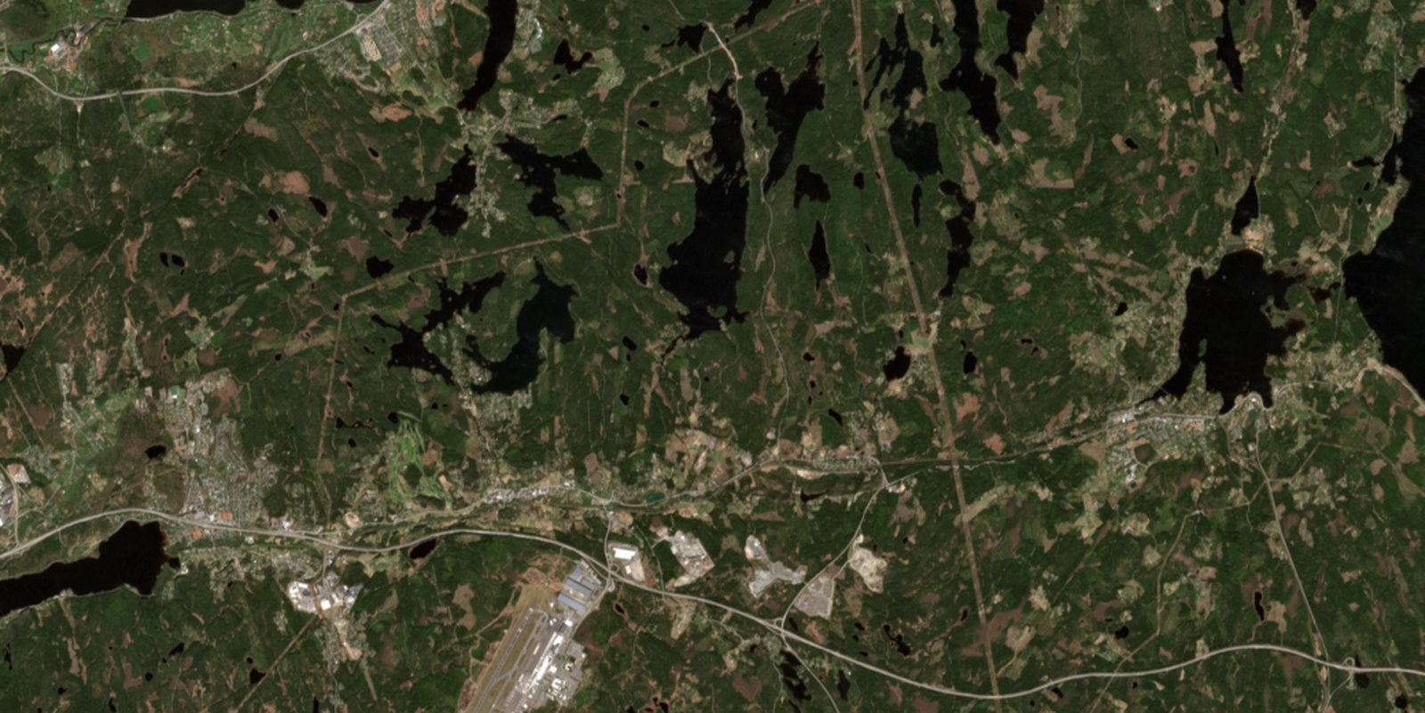
True-colour satellite pass over the forest outside Gothenburg Source · Sentinel-2 · 2026-05-05 Cloud 8% 57.71° N  12.42° E  ·  pass registered
Every pass, every parcel. Satellites cross every forest on Earth several times a week. Mai reads each new image the moment it lands and sets it against everything seen before — today mostly from ESA’s Sentinel-2, though the model was never built for one satellite.
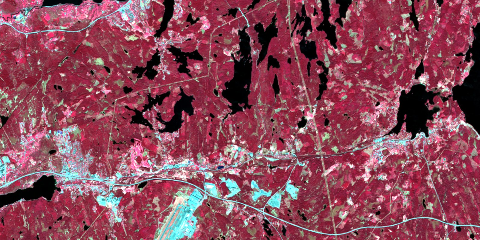
Near-infrared reading of the same forest — vegetation shows red Beyond the visible · what Mai reads Storm · windthrow 2.1 ha · 2 of 14 stands
Pixels become events. Mai turns raw imagery into things that actually happened — a harvest, a windthrow, a burn, a dry spell — each one located, sized, and dated. Nothing to interpret; the model does the reading.
The same forest, with modelled risk surfaces In development Risk surface · storm · drought Modelled from change history

Events become foresight. Years of change become a read on what’s coming — storm, fire, and drought — so the next one is expected, not discovered. In development, trained on the ground truth owners give back.

Most owners get out to their land only a few times a year — it’s often hours away, and life fills the gaps. The forest doesn’t wait, though: a harvest, a storm, a fire, or creeping drought can pass in those months, unseen.

Your eye sees a green forest. Mai reads the light it reflects — and the same forest becomes a map of how alive it is.

2026-05-05  ·  canopy 0.65  ·  moisture 0.18  ·  Δ +0.02  ·  healthy

Greener and a touch wetter than the week before — I’d call this a healthy stand

Imagery: Copernicus Sentinel-2, ESA — a forest outside Gothenburg

01

Draw your forest

Mark your land on the map — one parcel or a whole portfolio.

02

Mai watches it

Fresh satellite imagery every few days, scanned for harvest, storm, fire, and drought stress.

03

You get the alert

Plain-language alerts and PDF reports — and you can ask Mai questions in chat.

Free
SEK 0
 
 
Try Mai on your own forest. See what she sees.
Stand
SEK 500
/ quarter + VAT
 
Change detection on your own land, without the AI analysis.
Forester
SEK 2,000
/ quarter + VAT
 
Everything, up to 2,000 ha.
Larger forests
Tailored
 
 
More than 2,000 ha? Contact us.
Monitoring
Satellite imagery
4 passes
Every few days
Every few days
Every few days
Dual view (natural + infrared)
Canopy health graph
Local fire-risk (SMHI)
Detection
Harvest, storm damage, fire damage, drought stress
Likely cause from weather history
Intelligence
Chat with Mai about your land
PDF reports for any period
Scope
Your own forest
≤ 200 ha
≤ 200 ha
≤ 2,000 ha
> 2,000 ha

Free gives four satellite passes of your own forest — enough to see a full cycle of change. Continuous monitoring starts with Stand. All prices exclude VAT, billed quarterly.

Show me the forest you want me to watch. I'll take it from there

Try Mai