Backed by

Continuous satellite monitoring for private forest owners — harvest, storm, fire, and drought, with the likely cause from local weather. Plain-language alerts, no expertise required.
Mai is watching a forest outside Gothenburg right now→
Most owners walk their land only a few times a year. The forest doesn’t wait — a harvest, a storm, a fire, or creeping drought can pass unseen for months, until it’s already too late.
Your eye sees a green forest. Mai reads the light it reflects — and the same forest becomes a map of how alive it is.
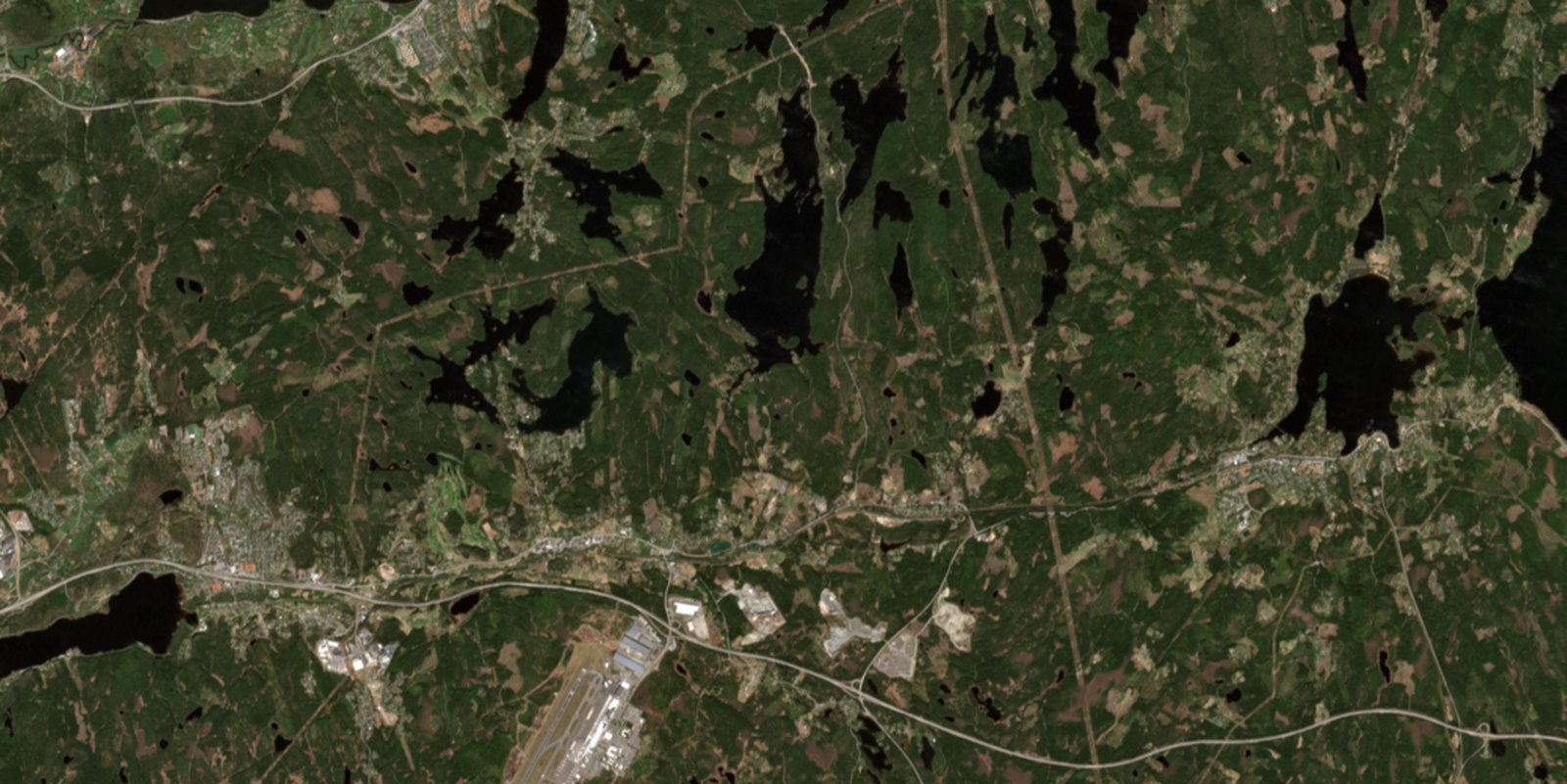
 What you see
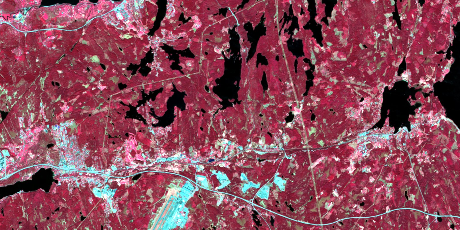
What Mai reads
What you see
What Mai reads
2026-05-05 · NDVI 0.653 · NDMI 0.181 · Δ +0.022 · healthy
Greener and a touch wetter than the week before — I’d call this a healthy stand
Imagery: Copernicus Sentinel-2, ESA — a forest outside Gothenburg
Mark your land on the map — one parcel or a whole portfolio.
Fresh satellite imagery every few days, scanned for harvest, storm, fire, and drought stress.
Plain-language alerts and PDF reports — and you can ask Mai questions in chat.
Free gives four satellite passes of your own forest — enough to see a full cycle of change. Continuous monitoring starts with Stand. All prices exclude VAT, billed quarterly.
Show me the forest you want me to watch. I'll take it from there
Try Mai